
My interdisciplinary thesis was part of both Department of Physical Geography & Department of Ecology, Environment and Plant Sciences (DEEP) in Stockholm University.
The entire project was automated using Python in Jupyter Notebook (Github link). See for the demonstrative video and the abstract below.
Below are some of the libraries I used:
- Google Earth Engine Python API for accessing Landsat Collections
- Pandas and GeoPandas to read data and shapefiles
- NumPy for array operations
- GDAL for raster to vector conversion
- Ipyleaflet for interactive mapping
- Matplotlib for plotting
- Geoplot for creating a choropleth map
Assessment of coastal erosion to create a seagrass vulnerability index in northwestern Madagascar using automated quantification analysis
Abstract
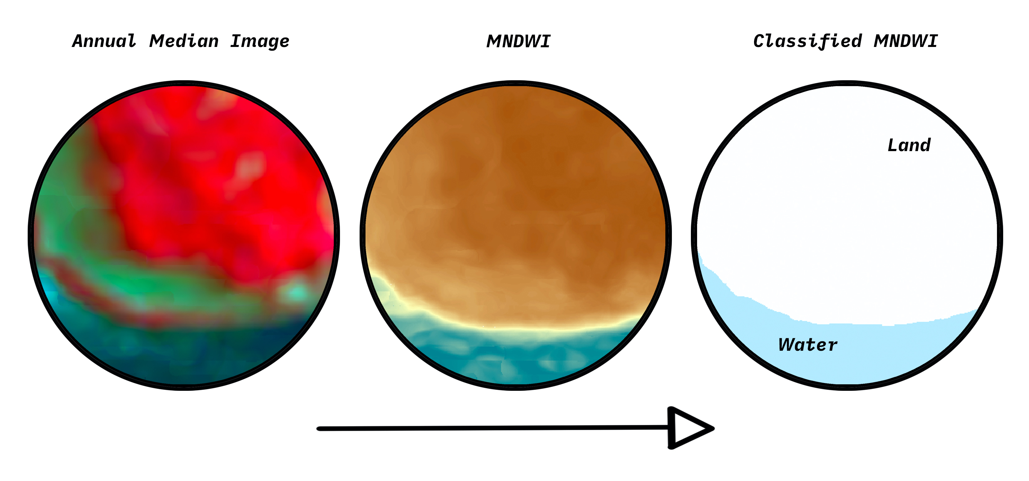
The seagrass extent has been declining globally. The human activities that are most likely to cause seagrass loss are those which affect the water quality and clarity. However, turbidity following coastal erosion is often left out from marine ecosystem vulnerability indices. This study quantified the coastal erosion for Tsimipaika Bay in northwestern Madagascar by using change detection analysis of satellite imageries. The annual coastal erosion data was then used to create an index for seagrass vulnerability to turbidity following coastal erosion. Considering that the height of seagrass species plays an important role in their survival following turbidity, the seagrass vulnerability index (SVI) was based on two factors; seagrass species height and their distance to the nearest possible erosion place. The results for the coastal erosion showed that the amount of erosion was particularly high in 1996, 2001 and 2009 for Tsimipaika Bay. The highest erosion occurred in 2001 with a land loss area of about 6.2 km2 . The SVI maps revealed that 40% of the seagrass communities had minimum mean SVI values in 2001 and 50% had the maximum mean SVI during the year 2009. This study showed that it is possible to use coastal erosion to measure seagrass vulnerability; however, the index requires configuration such as including the total amount of annual coastal erosion and incorporating bathymetric data. The entire project was built and automated in Jupyter Notebook using Python programming language, which creates a ground for future studies to develop and modify the project.
Keywords
Seagrass; Coastal erosion; Vulnerability index; Python; Google Earth Engine; Deforestation; Turbidity; Mangrove; Madagascar